Drones, UAV and RPA's
If you’re planning to fly a drone in the Tararua District, there are a few important things to check before you take off. Depending on where you’re flying, you may need permission from Council, a private landowner, or the Department of Conservation. All drone operators must also comply with Civil Aviation Authority rules.
- Drone: A common, informal term for a remotely controlled or automated aircraft. In most cases, when people say “drone” they are referring to a small flying device used for photography, recreation, or commercial work.
- UAV (Unmanned Aerial Vehicle): The aircraft itself. This is the technical term for a flying machine that operates without a pilot on board.
- RPA (Remotely Piloted Aircraft): The official aviation term used by the Civil Aviation Authority. It refers to an aircraft that is flown by a pilot on the ground using a remote control.
Flying a drone in parks, reserves and domains?
To fly in any park, reserve or domain in the Tararua District, you will need authorisation from Council.
Please note any operator of a UAV, drone or RPA system must:
- comply with all rules and regulations applicable to the operation of a remotely piloted aircraft system (including Part 101 of the Civil Aviation Rules and any other applicable rules or any rules and regulations amending or replacing the same);
- comply with the Privacy Commissioner guidelines relating to preserving peoples personal privacy when using a remotely piloted aircraft system;
- not operate the RPA system within 10 metres of any residential boundaries and buildings;
- not operate the RPA system within 12 metres of any overhead power or telecommunication cables;
- not fly the RPA system within 10 metres of any other users of the land it is being operated on;
- not operate the RPA system within 10 metres of or over any buildings or structures on the land it is being operated on;
- only operate the RPA system over the land authorised at all times and not over any road or roadway;
- ensure that all safety features (which shall include rotor guards on drones) are installed and maintained while in use; and
- cease operation if requested to do so by a Council staff member or representative.
Please ensure that you are familiar with the airspace in the Tararua District on the Airshare Map below:
View the Controlled/Restricted Airspace Map
Dannevirke Aerodrome
Please note that the Dannevirke Aerodrome is in close proximity to the township and therefore, it is important you understand the controlled and restricted Civil Aviation Authority rules
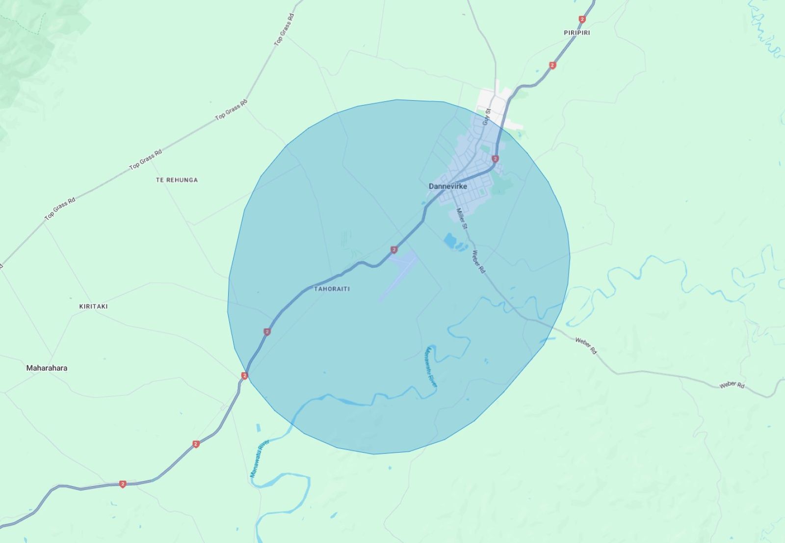
The Civil Aviation Autority (CAA) works to make sure everyone involved in New Zealand aviation meets the legal standards set by the Minister of Transport. The CAA sets out rules and regulations for operating drones in restricted or controlled airspaces. Its is important you abide by these rules and regulations or you may face a fine.
For the latest rules, please refer to Civil Aviation Authority guidance on flying dones and unmanned aircrafts.
If you want to fly over privately owned property, you need the property owner's permission.
Application for landowner/occupier consent
The Civil Aviation Authority designates controlled airspace on some parts of the Tararua District. In these areas you can only fly UAVs below the height of a nearby tree or structure, no further than 100m away.
Please ensure that you are familiar with the controlled airspace’s in the Tararua District on the Airshare Map.
In uncontrolled airspace, you can only fly UAVs up to a height of 120m, but please consider the safety and proximity of your drone to crowds.
To fly over conservation lands and waters, you need a concession or authorisation from the Department of Conservation.